A hiker on a rocky moraine below a wall of snow peaks on the Great Himalaya Trail

Plan the route the trail doesn't take.

Viatrail plans routes on and off the trail, splits them into days, and works with no signal.

Great Himalaya Trail, Nepal
Photo by Dave Brophy

Most map apps stop where the trail stops. Viatrail keeps going, and plans every night of the trip.

Cross-country routing

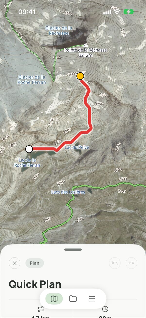
No trail data? Cross-country routing shows realistic routes over open ground.

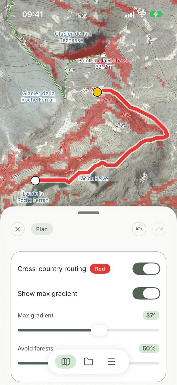
Set the steepest slope you'll walk, how much to avoid forest, and how strongly to prefer trails. The route updates to match.

  1. 1Long-press a start, then a destination.
  2. 2At a 45° limit the route climbs straight through the rock band: 1.7 km.
  3. 3Drop it to 37° and it goes round to the east: 2.6 km.
Trail Cross-country

Recorded in the app · Vanoise, France

Multi-day planning

Thinking about camping early today? One glance shows how that affects tomorrow and the next day.

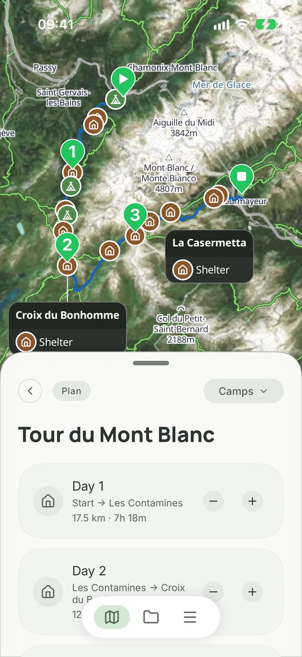
Put your camps where you want them. Viatrail shows the distance, climb and time for each day, and updates them when you move a camp.

  1. 1Four days of the Tour du Mont Blanc, from Les Houches to Courmayeur.
  2. 2Stop early on day one: 17.5 km becomes 8.2 km, at Auberge de Bionnassay.
  3. 3Every later day moves to the next hut, and the trip becomes five days.

Recorded in the app · Tour du Mont Blanc

Satellite or topo, on the trail and off it.

Switch between the topographic map and satellite imagery. Turn on slope shading to see where the ground gets too steep before you get there.

A cross-country route on satellite imagery in the Vanoise
A cross-country route on satellite
Red shading marks ground steeper than the chosen limit
Red shading marks ground steeper than your limit
A Tour du Mont Blanc plan with numbered day ends and huts
Day ends and huts along the Tour du Mont Blanc

Works with no signal

Large map downloads continue where they stopped when you lose signal.

Bring your files

Import GPX and KML files. KML import can keep the author's colours and folders.

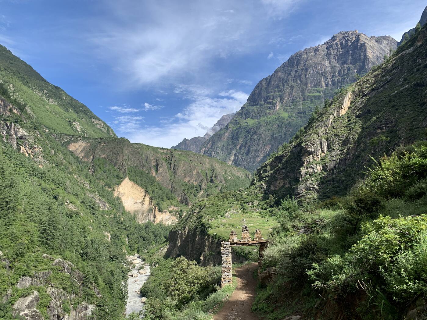
A trail through a stone gateway in a green Himalayan gorge

Made on the trail

For ten years, on almost every step, I was planning this app. Viatrail is the tool I wanted out there.

Dave Brophy, founder

  • Great Himalaya Trail
  • Greater Patagonia Trail
  • Pakistan
  • China
  • Across Europe

Building a route for other hikers?

See Viatrail for creators

The beta is open to invited testers.

Tell us where you hike. We send invites in small groups, on iPhone and Android.

We use your email only to send beta invites and news about Viatrail. Privacy